Posts

Showing posts from May, 2017

Blossoms and storm clouds
Image
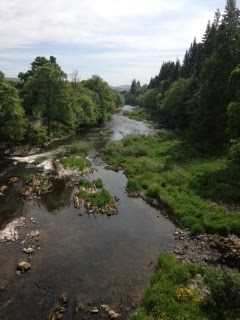
Blossoms and storm clouds   The last few days have seen a high pressure system move across the UK from the near continent producing a hot and humid end of May. The week itself dominated by the Manchester bombing, the inexplicable having to be lived with, as always we carry on. The high pressure now gets pushed back and Atlantic fronts reassert themselves but not before a dramatic period of thunderous weather has its say. This is promised from mid-day so we set out prepared to encounter a deluge at some point. The objective this week is Neidpath hill, sitting between Galashiels and Yair forest to the south. The route starts from Glenkinnon forest car park, runs back along the River Tweed to Yair bridge, joins the Southern Upland way as it heads west, loops steeply uphill to the top of Neidpath hill before completing the circuit by a return path to the opposite bank of the river and a short march through farmland to the stone bridge arching the river, close to the starting ca...

Around about Smailholm

Around about Smailholm Sunday 21st May The town of Galashiels sits within a horseshoe of low hills, with the ‘opening’ facing east towards the coast. Once you break free from the high ground you meet the low rich farm lands of Berwickshire running in easy sways and kleefs for nearly forty miles to the rough and dreary North Sea. The wide undulating valleys are topped with occasional small rocky escarpments, it is along one of these we find the main section of our route one blustery Sunday morning in late May. The small hamlet of Smailholm is our starting point to a   circular route that takes us first to the 15 th century Smailholm tower, standing sharp and proud, dominating the skyline. As a child Walter Scott stayed nearby, his boyish imagination inspired by the tower and its history. The summer holiday season sees a warden in situ. He provides a fascinating and succinct history of this Scottish keep and the warring factions that marauded across these lands four to fiv...

Bluebells and Birdsong

Image
. Bluebells and bird song A cold wet day sees us seek a sheltered river side walk along a stretch of Leader water. This tributary of the Tweed runs from the small town of Earlston to enter the main river below Leaderfoot bridge. Not far away the old Roman fort of Trimontium sits above this watery meeting spot. This section of the Leader sits within a narrow gorge producing an undulating path that dips between river side and the   higher ground above, producing views across the surrounding farm land or down into the river valley. The well-tended track, in place since 2010, runs either side with a metal foot bridge traversing a narrow canyon section about four kilometres from our starting point, allowing for an easy looped walk of about three hours.  The walk is dominated by the seasons awakening. We are accompanied throughout by a cacophony of bird song. Chaffinches, blue and grey tits, bullfinches,  pigeon, blackbirds and crow are everywher...

Walking about

Image
Walking about An early May day takes us onto the heights above Thorinlee, our interest having been peeked the previous weekend when the view across the valley from Housebyres identified two previously unexplored hills. Close to Galashiels and above the small hamlet of Clovenfords the low woods a popular walking and picnic area. A warm sun but bitingly cold wind accompanies us throughout. A quick pull up through the forest, in the company of a very friendly mountain biker, takes us to open moorland and with our destination clearly visible. A stone dyke runs all the way to the top and what path there is runs alongside it. We gain height quickly and suddenly off to our left tucked neatly into the valley floor sit the towns of Walkerburn and Innerleithan. From height and distance and with a bright Spring sun, both pretty as pictures, sat within the valley floor, the new seasons growth adding colour and vibrancy to the scene. We quickly reach the first top, and hunker down in t...