Posts

Stands of dark water

Image
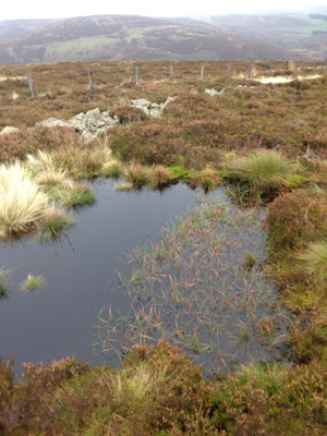
Stands of dark water 17th February 2018 Tucked into the folds of the Border hills lie glistening stands of dark   water. They appear suddenly when cresting a knoll or rounding   a bend or dropping from high ground into the pleat of a hill. All distinguished by location, size and setting, each with its own character and atmosphere. Some are steep sided and lethal, sitting deep into the ground with sharp drops from the surrounding land. Others seem to fit the land better, with gentle sloping access running easily from land to water and out again. Others are edged by trees and undergrowth that need passing before the waters edge is found. In the hills above Abbotsford house, close to Galashiels are two such lochs. The day is grey and cold as we pull quickly up onto the edge line of hills that runs to the south of the B6360. A small plantation of beech trees tops the main hill before   we head off to our right in search of the waymarked path.   The height we have...

Yarrowford to the Three Brethern

Image
Now in deep mid-winter the airstream has turned towards the north and for the last week, with one brief day of remission, snow and ice and a gurly wind have dominated our weather. Local hills are capped with white and onto these we take ourselves during the last weekend of the year. Four miles west of Selkirk, we cross a dog legged stone bridge to park up next to the village hall in Yarrow ford. The whole building, road side and detached, is painted in a garish red, at odds with its surroundings but adding colour to the dullness of an overcast winters day A Cicerone walkers guide arrived a few days ago so we trust to its exactitude and strike out for Walk 28, mysteriously called ‘In search   of an army’s pay chest’. A short pull up sees us reach open ground, with good views left and right. We stop to chat to a friends of Forbes while his girlfriend’s six year old son has a right old shindig with a young Alsatian dog on the snowy slope running down to the valley floor. Difficult t...

Three Hills

Image
Three Hills Saturday 15th December 2017    A mild blustery day sees us take a 10 kilometre loop around three small tops in the Moorfoot hills north of Clovenfords. We park up close to some farm buildings, oddly embedded in one of the old barns, sits a very old stone Border keep, in an advanced stage of dilapidation. Shortly, the road drops away and a long spacious valley appears stretching into the distance, dark and broody under a grey leaden sky. The ordinance survey map highlights a track pulling up from the valley floor about two kilometres ahead. Before long we round a bend to find a shooting lodge tucked into the hillside, shuttered and gated, the well-built stone structure, is surrounded by a neat gravel path and a smart picket fence. To its right a broad track leads uphill. We begin the long slow ascent to the first top, Great Law, at just over 500 metres. As we gain height we are increasingly buffeted by the cold northerly wind.   As always it takes t...

People and places

Image
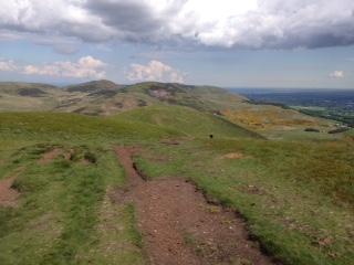
People and places Ashiestiel Hill – 4 th November 2017   Within thirty minutes we had reached the high point of the walk. Ashiestiel hill sits back from the A72, on ground above the long closed Peel hospital, a WW2 army hospital, converted to civilian use after the war before final closure in 1988. At twelve hundred feet the hill   provides a remarkable prospect over the Border terrain . Remarkable also, is the scarcity of farm dwellings or human habitation. A few large houses are tucked into the folds of the hill on the ground above the main road but nothing else takes the eye. The rough ground we have covered to reach this point is fit only for grazing, sheep and cattle scavenge among the heather and reeds to feed on hidden patches of grass and sedge. Most hills have some covering of conifers, either encasing or bisecting the hillside or appearing in ordered blocks of deep green on the flanks of the valleys. Fields, won back from the wildness of the plac...

A beguiling gloom

Image
‘A beguiling gloom’ 14 th October 2017 By mid-October the shooting season is well underway, attracting a large number of visitors to the area to partake in the dubious pleasure of blasting away at a range of feathered creatures. By accident we stumble across what we assume is a sort of open air game bird factory on our weekly perambulations around the Border countryside. Another overcast and gloomy morning but with a forecast of thinning cloud and some sunshine by lunchtime. Destination today is Seathope Law, sitting back from the A72, at a height of 542 metres; it sits close to the small hamlet of Clovernfords. We park next to a collection of houses scattered within the precincts of Holylee farm. Beyond the farm yard the track passes a well-built cairn marking a ‘holy well’ and a small damned up section of water, before striking uphill and away from Perlooie   burn, gurgling its way downhill to the Tweed river in the valley below.     It is here we begin to expe...

Mark of man

The mark of man October 7th 2017 Lindean reservoir sits on the high ground between Galashiels and Selkirk, about four kilometres east of the A7. Much of the site was dug out by hand back in the 18 th century when farmers extracted the lime rich marl clay as fertiliser. Now an impressive stretch of water with the lime rich soil, unusual in Scotland, maintaining a diverse plant population. We circle its northern bank on a dull, windy Saturday morning in early October before taking a sharp turn onto a path that runs perpendicular to the loch and running alongside the towering telecommunications tower that occupies this site. Tethered to the ground by soaring steel cables, the mast itself and the building that sits beneath it are odd additions to the landscape, military in appearance but nothing more interesting than a radio and TV communications tower, put in place in 1961 to bring ITV to the South of Scotland. Odd too its existence in this age of satellites. We drop back onto ...

Up the Dam valley

Up the Dam valley 5 th August 2017 This week up and down Damhead valley running south from the Border hamlet   of Traquair, set in the heart of the Tweed valley. A day of sunshine and sudden heavy downpours, shot blasts of rain disappear quickly on a strong westerly. The returning sun bright and intense, seeding colour and light back onto forest and hillside. The rapid weather changes engaging us differently in the landscape. Sometimes huddled and protected under a leaden sky, suddenly released to a warm uplifting sun. The valley a thing onto itself, as all valleys are, protected places. McFarlane refers to them as sanctuaries that, ‘possess the allure of lost worlds or secret gardens’ * This particular one gathers a greater sense of isolation the further it pulls us from the village below. First a slow drag up , passing a demolished bothy and a strange sort of memorial garden to local horses. Their names listed on roof slates attached to the stone dykes, some recou...

Under a green canopy

Image
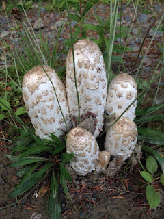
Under a green canopy 29th July 2017 The small village of Walkerburn straddles the A72 as it runs west from Galashiels before disappearing into the wilds of South Lanarkshire. A former mill town, the surrounding hills now provide new wealth from the timbers grown on them and the bike riders that make use of the tracks and pathways that run through them. On this blustery Saturday in late July we make use of these same forest roads to complete an 8 mile circular walk beginning and ending in the small car park that sits adjacent to the River Tweed. This is not a   difficult route, the most strenuous section is the long slow pull up to the height of Middleburn Knowe, a top of 414 metres. After passing through the settlement at Glenbenna we keep to the side of a small stream before a sharp turn left starts us on the upward pull. At this junction sitting proudly by the roadside and entangled by some long grasses, sits an impressive stand of Shaggy Ink mushrooms; columns of whi...

Old ways and byways

'Duchess walk' - Bowhill:- Selkirk July 15th At one time ownership of land in Scotland was distributed based on loyalty to King or Queen. From such beginnings the great sporting estates of Scotland were born. Bowhill on the   banks of the   river Yarrow, in the Scottish Borders, is one such example Gifted to the Scott clan in 1322 by Robert the Bruce for services rendered it has,   despite some upheavals over the years,   remained largely intact as a   country estate. The house and gardens are now in the ownership of the Buccleugh family, ancestors of the Scotts. On a damp sultry Saturday we park up on the edge of the estate and take the so called ‘Duchess track’ that provides a circular route of seven miles, through and around this settled realm. Heading away from the main house we quickly find ourselves alongside the tower house of Newark castle. In good condition despite it’s nearly 700 years of existence. One of many Border keeps built to ...

Up and down the River Tweed

Image
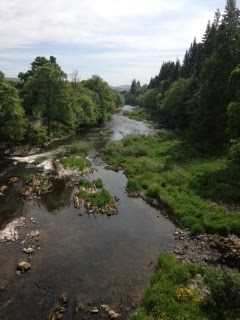
Up and down the River Tweed 8th July 2017 A warm summers day sees us walk a stretch of the River Tweed where it bisects the B6404 between St Boswells and Kelso in the Scottish Borders. At this point the river loops back and forth on itself, carving a path that creates waterside cliffs of red sandstone on one side, on the other, flat flood plains that quickly give way to fertile farmland. We park close to the riverside before crossing Mertoun Bridge to drop to the water’s edge down some timber steps. Our route keeps us close to the water throughout, running three miles east before re-crossing the river on the foot bridge adjacent to Mertoun house before returning on the far bank.   The outward stretch sees the track rise and fall through the dips and hollows of the high ground that lines this side of the river. Wooden steps and walkways allow for easy navigation, the high sections through woodland opening at times to expose slices of the river, glistening and bright in the m...

Highs and lows

Image
Highs and lows of the Pentland hills The Pentland hills sit to the south of Edinburgh, running in a line for twenty miles west to the Clyde valley. The city itself occupies a strip of land between the high ground and the shore of the Firth of Forth, while further to the south, across a wide fertile plain, the Border hills edge the sky line.   Driving out of the city on the A702, we park up at the Flotterstone Inn , finding a place in a crowded car park. The day is warm and bright, with some light showers forecast for early afternoon. The good weather has brought out walkers and cyclists and we pass many of them throughout the coming hours. Most friendly and happy to exchange greetings, others with clear ‘do not disturb’ demeanours. march on avoiding any eye contact. The early section involves a fairly steep pull up across open hill side with views gradually opening up from the south flank of the range. We reach the top of Turnhouse hill within 40 minutes, the first in a l...

Blossoms and storm clouds

Image
Blossoms and storm clouds   The last few days have seen a high pressure system move across the UK from the near continent producing a hot and humid end of May. The week itself dominated by the Manchester bombing, the inexplicable having to be lived with, as always we carry on. The high pressure now gets pushed back and Atlantic fronts reassert themselves but not before a dramatic period of thunderous weather has its say. This is promised from mid-day so we set out prepared to encounter a deluge at some point. The objective this week is Neidpath hill, sitting between Galashiels and Yair forest to the south. The route starts from Glenkinnon forest car park, runs back along the River Tweed to Yair bridge, joins the Southern Upland way as it heads west, loops steeply uphill to the top of Neidpath hill before completing the circuit by a return path to the opposite bank of the river and a short march through farmland to the stone bridge arching the river, close to the starting ca...

Around about Smailholm

Around about Smailholm Sunday 21st May The town of Galashiels sits within a horseshoe of low hills, with the ‘opening’ facing east towards the coast. Once you break free from the high ground you meet the low rich farm lands of Berwickshire running in easy sways and kleefs for nearly forty miles to the rough and dreary North Sea. The wide undulating valleys are topped with occasional small rocky escarpments, it is along one of these we find the main section of our route one blustery Sunday morning in late May. The small hamlet of Smailholm is our starting point to a   circular route that takes us first to the 15 th century Smailholm tower, standing sharp and proud, dominating the skyline. As a child Walter Scott stayed nearby, his boyish imagination inspired by the tower and its history. The summer holiday season sees a warden in situ. He provides a fascinating and succinct history of this Scottish keep and the warring factions that marauded across these lands four to fiv...

Bluebells and Birdsong

Image
. Bluebells and bird song A cold wet day sees us seek a sheltered river side walk along a stretch of Leader water. This tributary of the Tweed runs from the small town of Earlston to enter the main river below Leaderfoot bridge. Not far away the old Roman fort of Trimontium sits above this watery meeting spot. This section of the Leader sits within a narrow gorge producing an undulating path that dips between river side and the   higher ground above, producing views across the surrounding farm land or down into the river valley. The well-tended track, in place since 2010, runs either side with a metal foot bridge traversing a narrow canyon section about four kilometres from our starting point, allowing for an easy looped walk of about three hours.  The walk is dominated by the seasons awakening. We are accompanied throughout by a cacophony of bird song. Chaffinches, blue and grey tits, bullfinches,  pigeon, blackbirds and crow are everywher...

Walking about

Image
Walking about An early May day takes us onto the heights above Thorinlee, our interest having been peeked the previous weekend when the view across the valley from Housebyres identified two previously unexplored hills. Close to Galashiels and above the small hamlet of Clovenfords the low woods a popular walking and picnic area. A warm sun but bitingly cold wind accompanies us throughout. A quick pull up through the forest, in the company of a very friendly mountain biker, takes us to open moorland and with our destination clearly visible. A stone dyke runs all the way to the top and what path there is runs alongside it. We gain height quickly and suddenly off to our left tucked neatly into the valley floor sit the towns of Walkerburn and Innerleithan. From height and distance and with a bright Spring sun, both pretty as pictures, sat within the valley floor, the new seasons growth adding colour and vibrancy to the scene. We quickly reach the first top, and hunker down in t...